Proposed Thames Embankment
Date:
1862
Reference:
WORK 38/99
Creator:
Successive Works departments, and the Ancient Monuments Boards and Inspectorate
Catalogue context:
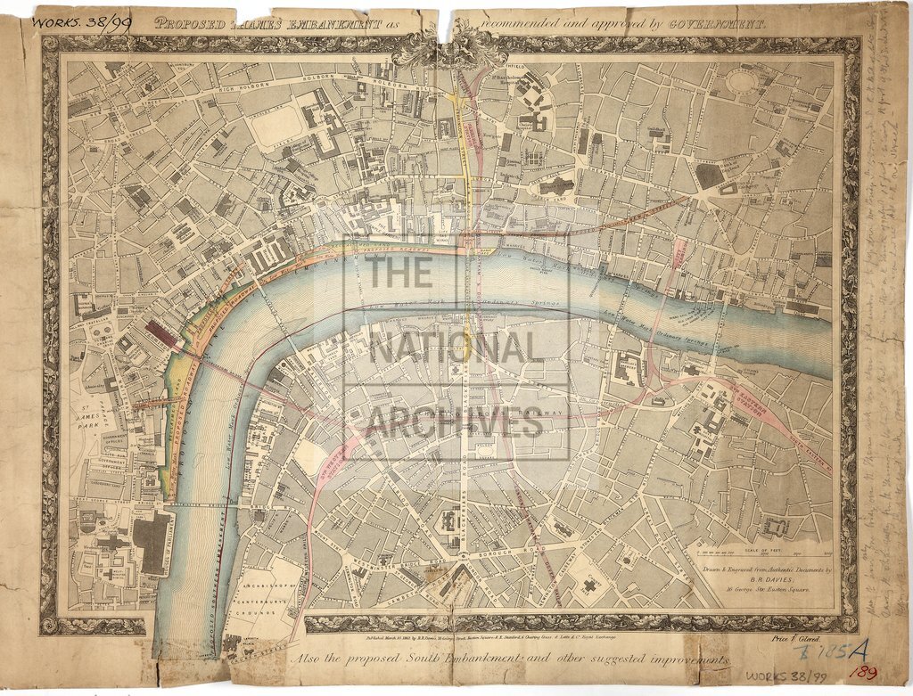
River Thames: Embankments. Map showing the river from Horseferry Stairs to St Katharine Dock, the North Embankment from Westminster Bridge to near Greenhithe Dock and South Embankment from Lambeth Palace to near Blackfriars Bridge. Scale: 1 inch to 440 feet. Drawn and engraved by B R Davies. Notes added in pencil.
Categories:
Buildings and architecture
Subjects:
Ancient Monuments and Historical Buildings; Maps and plans
Topics:
Land and buildings; Arts and culture
Period:
Victorians
Copyright information:
Copyright clearance for publication is not required, except in the case of documents in third-party copyright.
Usage terms:
https://www.nationalarchives.gov.uk/documents/information-management/use-of-tna-materials.pdf