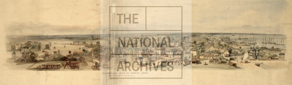
George Town British Guina illustration by Edward Goodall
Date:
1841
Reference:
CO 700/BritishGuiana23
Creator:
Colonial Office, Commonwealth and Foreign and Commonwealth Offices, Empire Marketing Board, and related bodies
Catalogue context:
Map of the Limits between British Guiana and Venezuela, as surveyed and drawn by Robert H. Schomburgk under Her Majesty's Commission. [Demerara]. [M.S.] About 2¼ miles to 1 inch.
Categories:
Colonial and Empire; Overseas
Subjects:
Americas; International; Maps and plans
Topics:
Land and buildings; International trade and affairs
Period:
Empire And Industry
Copyright information:
Copyright clearance for publication is not required, except in the case of documents in third-party copyright.
Usage terms:
https://www.nationalarchives.gov.uk/documents/information-management/use-of-tna-materials.pdf