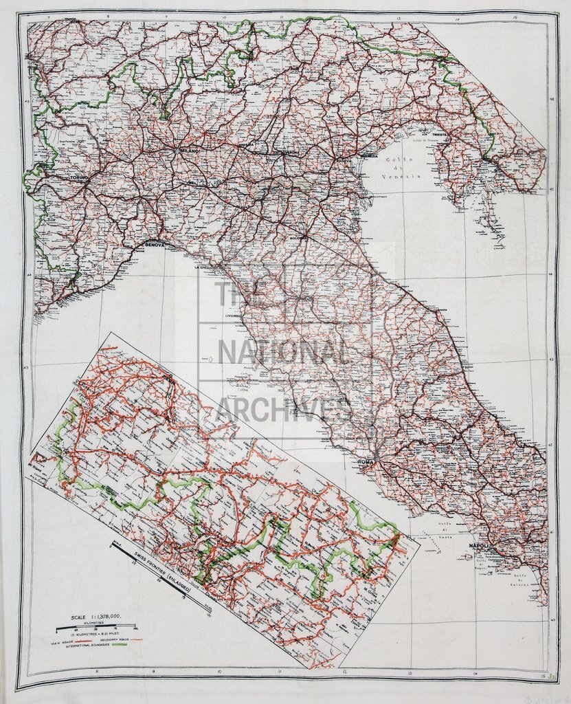
Escape map of Northern Italy, southern Switzerland, and adjacent areas of France, Austria and Yugoslavia c1942
Date:
1942
Reference:
MF 1/15/1
Creator:
Maps and plans extracted to flat storage from records of various departments
Catalogue context:
Map of northern Italy, southern Switzerland, and adjacent areas of France, Austria and Yugoslavia, between 40°N and 47°N and between 7°E and 15°E. Shows rivers, roads, place-names and international boundaries. Inset: 'Swiss Frontier (Enlarged)', a map of the frontier area between Lausanne and Gargellen. Latitudes and longitudes shown. 'J.3' printed in green at lower left corner.
Categories:
Overseas; Second World War
Subjects:
Archives and libraries; Europe and Russia; Maps and plans
Topics:
International trade and affairs; Land and buildings; Military and war
Period:
Second World War
Places:
France; Italy
Copyright information:
Copyright clearance for publication is not required, except in the case of documents in third-party copyright.
Usage terms:
https://www.nationalarchives.gov.uk/documents/information-management/use-of-tna-materials.pdf