Escape map of Southern Germany between Freiburg im Breisgau, Basel, Schaffhausen and Tuttlingen c1942
Date:
1942
Reference:
MF 1/15/2
Creator:
Maps and plans extracted to flat storage from records of various departments
Catalogue context:
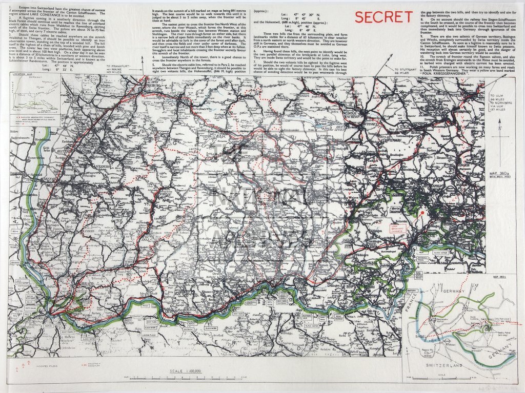
Map of southern Germany between Freiburg im Breisgau, Basel, Schaffhausen and Tuttlingen, showing rivers (principally the Rhine), lakes, altitudes, pylons; river and border crossing points; distances to Frankfurt am Main, Stuttgart, Ulm and Nuremburg. Extensive notes concerning crossing-points and topographical features, including remarks on the flow of the Rhine. Insets: (1) location map; (2) meeting point of Switzerland, Germany and France near Basel, showing railway stations, customs posts, sentries, bridges, mountain paths. Latitudes and longitudes shown. Compass indicator. Stamped in red: 'Secret'. In margin: 'Map 360a with 360c Inset'. Dimensions of sheet: 57 cm x 42 cm.
Categories:
Overseas; Second World War
Subjects:
Archives and libraries; Europe and Russia; Maps and plans; Railways
Topics:
International trade and affairs; Land and buildings; Military and war; Transport and travel
Period:
Second World War
Places:
Germany
Copyright information:
Copyright clearance for publication is not required, except in the case of documents in third-party copyright.
Usage terms:
https://www.nationalarchives.gov.uk/documents/information-management/use-of-tna-materials.pdf