Provincial Autonomy Plan map of Palestine
Date:
1946
Reference:
MFQ 1/461 (1)
Creator:
Maps and plans extracted to flat storage from records of various departments held at the Public Record Office, Kew
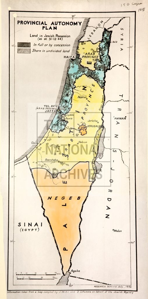
Catalogue context:
1 item (originally enclosed with a print of a Statement of Policy on Palestine, 26 July 1946) extracted from FO 800/485 . Palestine. 'Provincial Autonomy Plan' map (of territory now in Israel, the West Bank and the Gaza Strip), showing land in Jewish possession as at 31 December 1944. Reference table to land held in full or by concession and shared land. Scale: 1 inch about 16 miles. Information taken from a map compiled by J Weitz and Z Lifschitz on behalf of the Jewish Agency; produced by the Foreign Office Reseach Department, July 1946. Map and policy statement were found among the private papers of Ernest Bevin.
Categories:
Overseas; Second World War
Subjects:
Archives and libraries; International; Maps and plans; Middle East; Personal and family papers; Religions
Topics:
Family and identity; International trade and affairs; Land and buildings; Military and war; Religion
Period:
Postwar
Places:
Palestine
Copyright information:
Copyright clearance for publication is not required, except in the case of documents in third-party copyright.
Usage terms:
https://www.nationalarchives.gov.uk/documents/information-management/use-of-tna-materials.pdf