Map, The Underbelly of the Axis
Date:
1943
Reference:
MFQ 1/687
Creator:
Maps and plans extracted to flat storage from records of various departments held at the Public Record Office, Kew
Catalogue context:
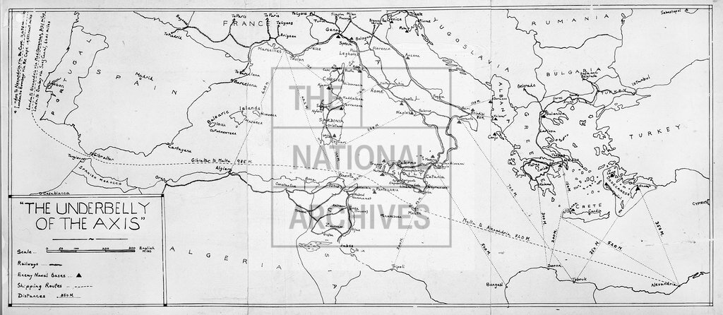
1 item extracted from INF 1/684 . Map showing the Mediterranean Sea west of Cyprus, the rail networks of Algeria, France, Greece and Italy, the principal cities, naval bases and borders of neighbouring countries and sea lanes with distances. Scale: 1 inch to 127 miles. Issued as Annexe VI to the Central Directive of the Political Warfare Executive, 21 April 1943, to illustrate Annexe I: 'The Underbelly of the Axis'.
Categories:
Second World War
Subjects:
Archives and libraries; Europe and Russia; Maps and plans; Middle East; Navy
Topics:
International trade and affairs; Land and buildings; Military and war
Period:
Second World War
Copyright information:
Copyright clearance for publication is not required, except in the case of documents in third-party copyright.
Usage terms:
https://www.nationalarchives.gov.uk/documents/information-management/use-of-tna-materials.pdf