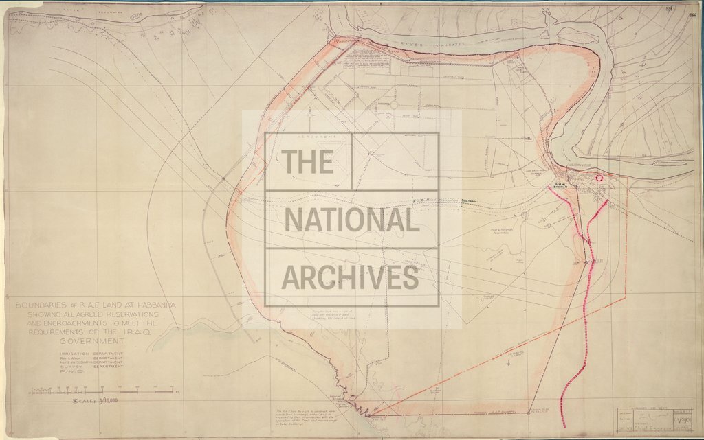
Boundaries of RAF land at Habbaniya Iraq
Date:
1939
Reference:
MPKK 1/67 (2)
Creator:
Maps and plans extracted to extra large flat storage from records of the Foreign Office
Catalogue context:
3 items extracted from FO 371/24560 . Iraq. 3 maps of British military land. (1)-(2) 'Boundaries of RAF land at Habbaniya showing all agreed reservations and encroachments to meet the requirements of the Iraq government': 2 copies. Compass indicator. Different MS amendments, coloured, to each item. (3) 'Sketch Map - Musaiyib Area': showing the River Euphrates, the barracks, a campsite, a factory, the settlement, the railway station, and an area of cultivation. Compass indicator. Taken from an air photograph. Dimensions: (1)-(2) each 75 cm x 123 cm; (3) 23 cm x 72 cm.
Categories:
Second World War
Subjects:
Air Force; Archives and libraries; Common land; International; Manufacturing; Maps and plans; Middle East; Railways
Topics:
Business, finance and innovation; International trade and affairs; Land and buildings; Military and war; Transport and travel
Period:
Second World War
Copyright information:
Copyright clearance for publication is not required, except in the case of documents in third-party copyright.
Usage terms:
https://www.nationalarchives.gov.uk/documents/information-management/use-of-tna-materials.pdf