Balaklava
Date:
1856
Reference:
MPH 1/121
Creator:
Maps and plans extracted to flat storage from records of the War Office
Catalogue context:
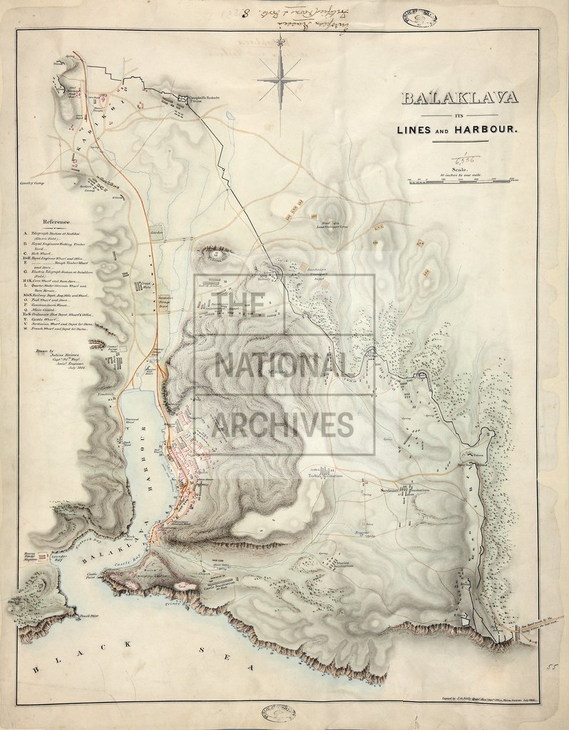
Russia. 'Balaklava its Lines and Harbour': relief map showing fortifications and buildings in Balaklava and surrounding district. Reference table. Compass indicator. Drawn by Julius Raines, Capt 95th Regt, July 1855. Copied by J G Kelly, QMG's Office, Horse Guards, July 1856.
Categories:
Crime and punishment; Military; Overseas
Subjects:
Crimean War; Archives and libraries; Armed Forces (General Administration); Army; Asia; Europe and Russia; Maps and plans
Topics:
International trade and affairs; Land and buildings; Military and war
Period:
Victorians
Places:
Crimea
Copyright information:
Copyright clearance for publication is not required, except in the case of documents in third-party copyright.
Usage terms:
https://www.nationalarchives.gov.uk/documents/information-management/use-of-tna-materials.pdf