Chatham Dockyard
Date:
1721
Reference:
MPH 1/247
Creator:
Maps and plans extracted to flat storage from records of the War Office
Catalogue context:
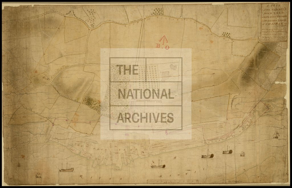
'A Plan of His Majesty's Dockyard, Ordnance Wharfe and Purchased Lands at Chatham, Kent'. Shows tenements purchased in 1709 and land purchased in 1719; numbered boundary stones. Scale: 1 inch to 200 feet. Drawn by C Lempriere, 1721.
Categories:
Military; Naval; Overseas
Subjects:
Archives and libraries; Armed Forces (General Administration); Army; Manufacturing; Maps and plans; Navy
Topics:
Business, finance and innovation; International trade and affairs; Land and buildings; Military and war
Period:
Early Modern
Copyright information:
Copyright clearance for publication is not required, except in the case of documents in third-party copyright.
Usage terms:
https://www.nationalarchives.gov.uk/documents/information-management/use-of-tna-materials.pdf