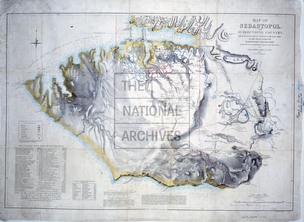
Sebastopol, showing Russian defences and Allied armies
Date:
1857
Reference:
MPH 1/427
Creator:
Maps and plans extracted to flat storage from records of the War Office
Catalogue context:
Ukraine: Crimea: 'Map of Sebastopol and Surrounding Country. Shewing the Russian defences, positions of the Allied armies, and their trenches, together with the British military & naval burial grounds ...'. Also shows bays, soundings, rivers, railways. Reference table; table of dates of principal events during war with Russia; table of distances; notes on electric telegraph, Balaklava railway and Sebastopol docks. Scale stated as '2 Inches to a Mile' [1:31.680], but scale bar indicates 1 inch to 900 yards [1:32,400]; a pencilled note comments, 'Scale is wrong.' Compass indicator. Compiled by Frederick Brine, Capt RE, FRGS. Engraved by B R Davies, 16 George Street, Euston Square, London. Published by Ackermann & Co, 106 Strand, London. With coloured MS additions. A note reads: 'This Map is published in connection with the Work entitled "The Last of the Brave " by Captains... John Colborne 60 th Royal Rifles... & Frederick Brine ...'. Filed with the map are press reviews of The Last of the Brave .
Categories:
Crime and punishment; Military; Overseas
Subjects:
Crimean War; Archives and libraries; Armed Forces (General Administration); Army; Asia; Communications; Europe and Russia; Maps and plans; Navy; Railways
Topics:
Arts and culture; International trade and affairs; Land and buildings; Military and war; Transport and travel
Period:
Victorians
Places:
Crimea; Russia
Copyright information:
Copyright clearance for publication is not required, except in the case of documents in third-party copyright.
Usage terms:
https://www.nationalarchives.gov.uk/documents/information-management/use-of-tna-materials.pdf