Map of Crimea by the Topographical and Statistical Department of the War Office
Date:
1856
Reference:
MPH 1/428
Creator:
Maps and plans extracted to flat storage from records of the War Office
Catalogue context:
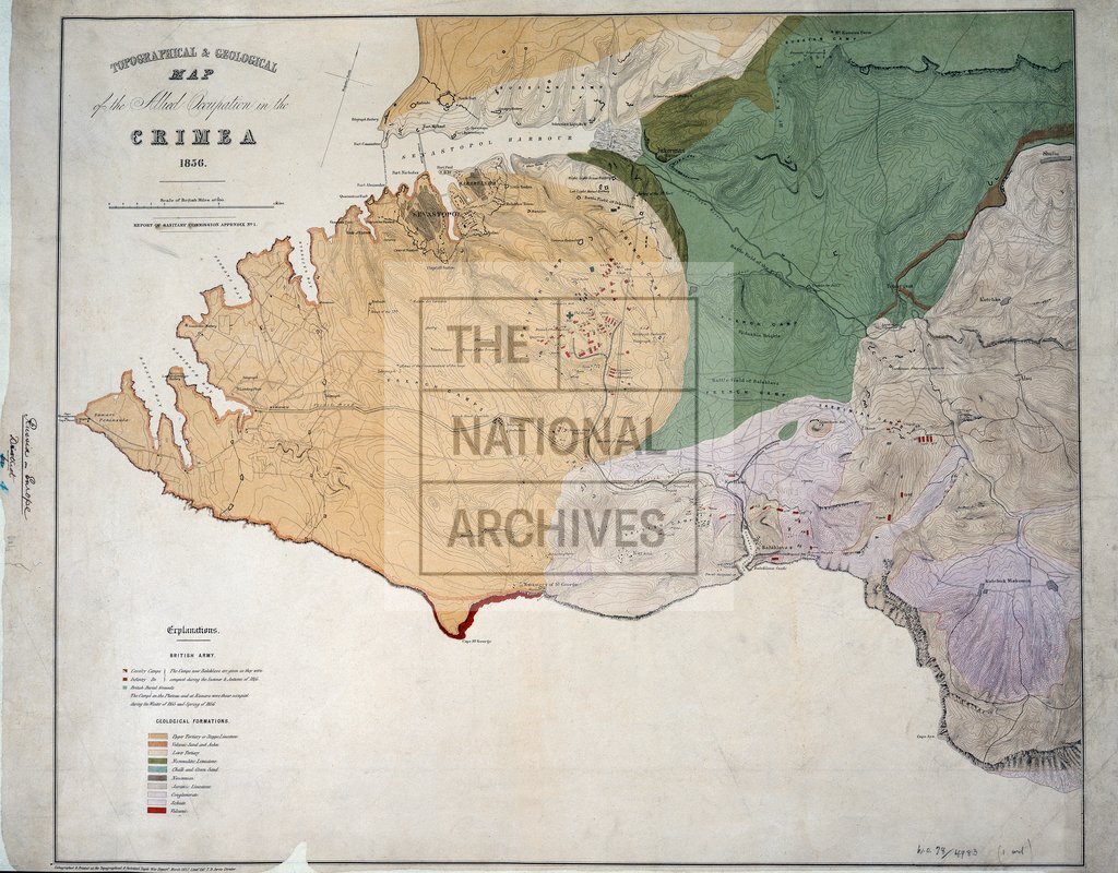
Ukraine: 'Topographical & Geological Map of the Allied Operation in the Crimea 1856'. Reference table to geological formations; British Army camps. Compass indicator. Lithographed and printed at the Topographical & Statistical Depot, War Department, Lt Col T.B. Jervis Director, March 1857.
Categories:
Crime and punishment; Military; Overseas
Subjects:
Crimean War; Archives and libraries; Armed Forces (General Administration); Army; Europe and Russia; Maps and plans
Topics:
International trade and affairs; Land and buildings; Military and war
Period:
Victorians
Places:
Crimea
Copyright information:
Copyright clearance for publication is not required, except in the case of documents in third-party copyright.
Usage terms:
https://www.nationalarchives.gov.uk/documents/information-management/use-of-tna-materials.pdf