Plan showing Charge of the Light Brigade
Date:
1854-1863
Reference:
MPN 1/23
Creator:
Maps and plans extracted to flat storage from records of the Court of King's Bench
Catalogue context:
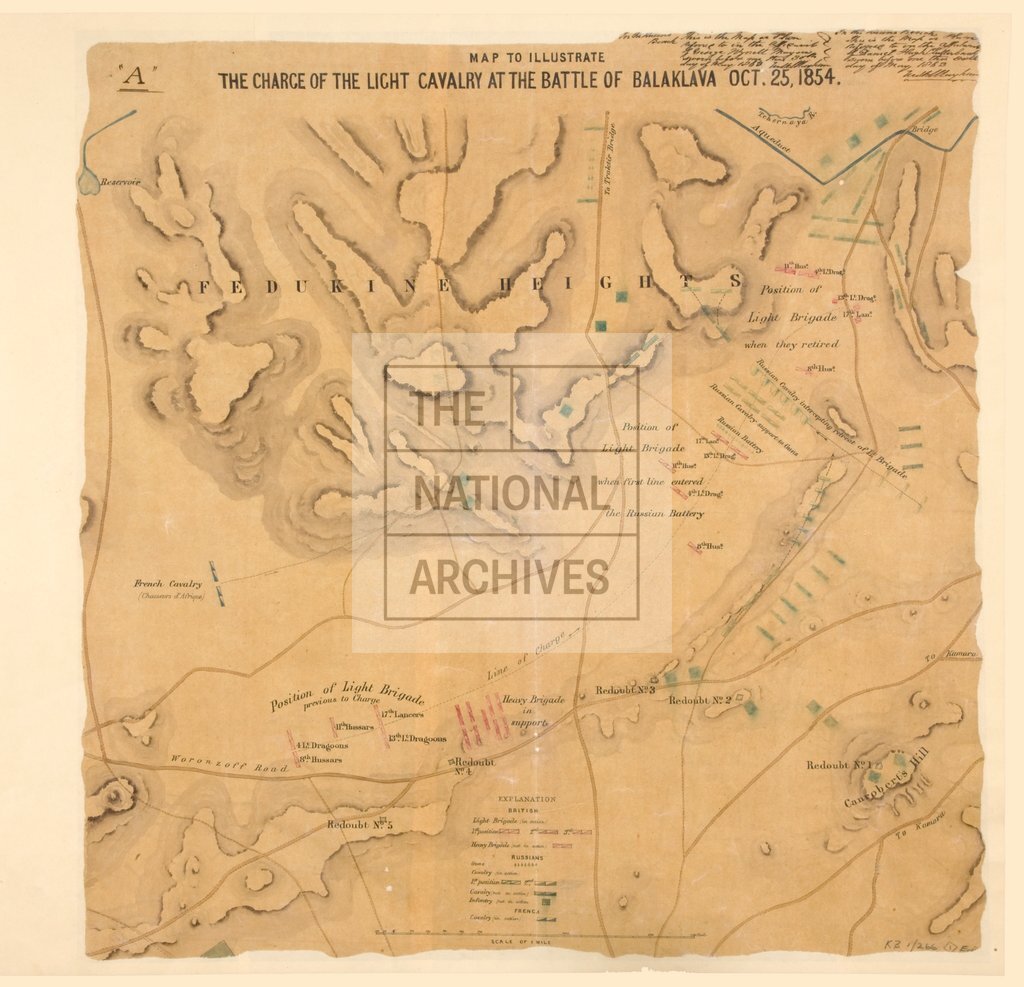
1 item extracted from KB 1/266 . Ukraine. 'Map to illustrate the charge of the light cavalry at the battle of Balaklava Oct. 25, 1854'. Shows the changing positions of the British and Russian troops and artillery; contours and roads. Reference table. Annotations state that this is the plan referred to in the affidavits of George Wynell Mayon and Daniel Hugh Clutterbuck, sworn 30 May 1863.
Categories:
Crime and punishment; Military; Overseas
Subjects:
Crimean War; Archives and libraries; Conflict; Europe and Russia; Litigation; Maps and plans; Weapons
Topics:
Crime, courts and justice; International trade and affairs; Land and buildings; Military and war
Period:
Victorians
Places:
Crimea
Copyright information:
Copyright clearance for publication is not required, except in the case of documents in third-party copyright.
Usage terms:
https://www.nationalarchives.gov.uk/documents/information-management/use-of-tna-materials.pdf