Tombeau Bay, Pointe aux Cannoniers, fortifications and battery, Mauritius
Date:
1863
Reference:
WO 78/39
Creator:
War Office, Armed Forces, Judge Advocate General, and related bodies
Catalogue context:
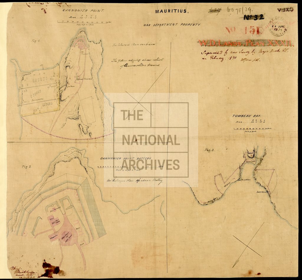
Mauritius. Three maps on a single sheet. (i) 'Tombeau Bay': showing a redoubt, entrenchment, and batteries. Scale: 1 inch to about 480 yards [1:17,280]. Compass indicator. (ii) Map of Point aux Canonniers, showing fortifications and a quarantine ground. Scale: 1 inch to 300 feet [1:3,600]. Compass indicator. (iii) Detailed plan of the battery at Pointe aux Canonniers. Scale: 1 inch to 60 feet [1:720]. Copied by Lieutenant E Micklem, Royal Engineers, 19 November 1863. An additional note, apparently relating to (i), states: 'Superseded by new Survey by Maj. [E T] Brooke, R.E., in February 1871'; signed by Lieutenant W P Jones, Royal Engineers. Stamped at the Royal Engineers' Office, Mauritius, 14 June 1875.
Categories:
Military
Subjects:
Africa; Armed Forces (General Administration); Army; Maps and plans; Operations, battles and campaigns
Topics:
International trade and affairs; Land and buildings; Military and war
Period:
Victorians
Copyright information:
Copyright clearance for publication is not required, except in the case of documents in third-party copyright.
Usage terms:
https://www.nationalarchives.gov.uk/documents/information-management/use-of-tna-materials.pdf