Siege of Badajoz
Date:
1812
Reference:
WO 78/1017/7/16
Creator:
War Office, Armed Forces, Judge Advocate General, and related bodies
Catalogue context:
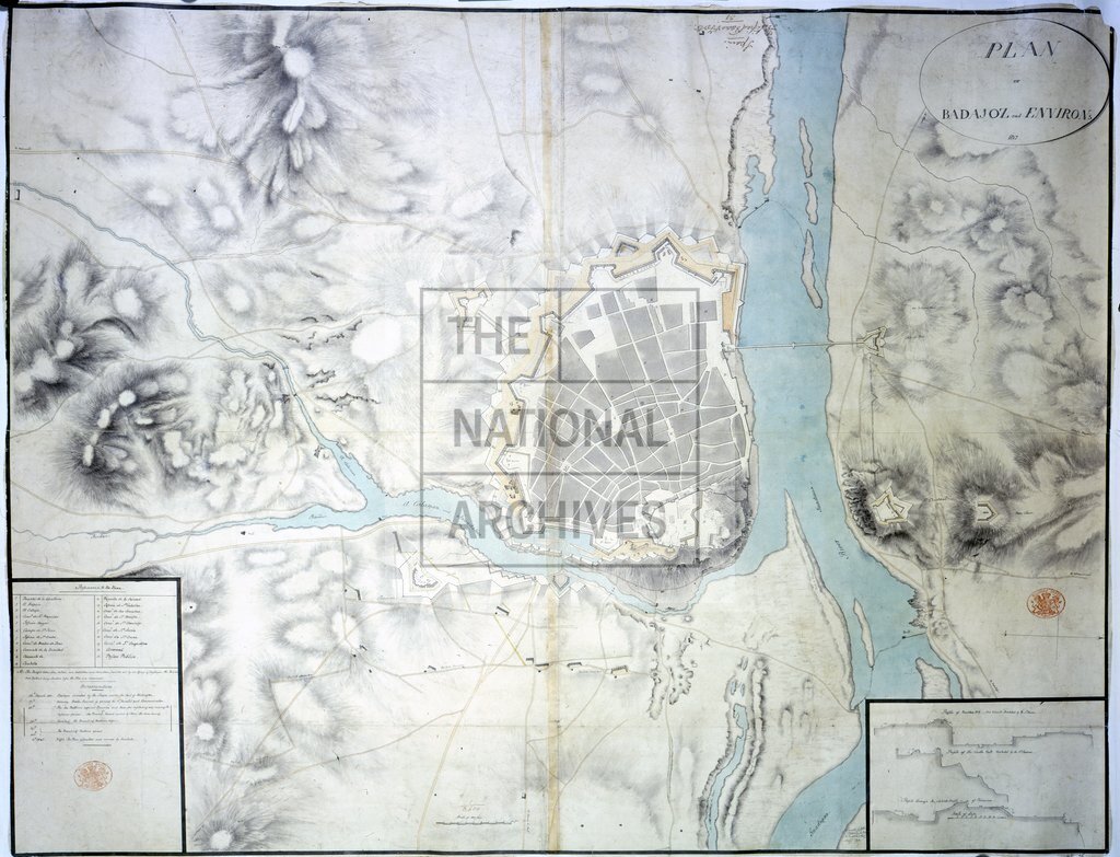
Spain. 'Plan of Badajoz and Environs 1812': map showing the city under siege [by British forces]. Reference table to religious houses and other principal buildings; notes on progress of the siege. Scale: 1 inch to 300 feet. Compass indicator. Insets: profiles of number 1 bastion, the castle wall and of the salient angle of the Picurina, all under attack.
Categories:
Military
Subjects:
Armed Forces (General Administration); Army; Europe and Russia; Maps and plans; Religions
Topics:
International trade and affairs; Land and buildings; Military and war; Religion
Period:
Empire And Industry
Copyright information:
Copyright clearance for publication is not required, except in the case of documents in third-party copyright.
Usage terms:
https://www.nationalarchives.gov.uk/documents/information-management/use-of-tna-materials.pdf