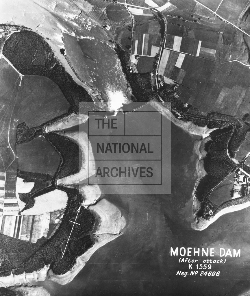
Moehne Dam after attack
Date:
17 May 1943
Reference:
AIR 34/609
Creator:
Air Ministry, the Royal Air Force, and related bodies
Catalogue context:
Target Folder: Mohne and Eder Dams: interpretation reports and photographs. 19 vertical aerial photographs, described below, have been included within this folder, which are accompanied by photographic interpretations and maps. Note the variant spellings of Mohne, Möhne and Moehne. (Folio 21) 1 photograph, No 5078, annotated on the front of the photograph with compass indicator and the words"Moehne Dam (before attack) K 1559 Neg No 24685", size: 23cm x 18cm, 5 April 1943. (Folio 22) 1 photograph, No 5036, of"the village of Dellwig, South of Unna, showing a further bridge broken down and the village flooded", size: 23cm x 18cm, 17 May 1943. (Folio 23 -24 ) 2 photographs No 3019 & 3022, showing road and canal junctions, bridge and canal traffic, all size: 23cm x 18cm, 18 June 1943. (Folio 25 - 26) 2 photographs, Nos 5108 & 5109, showing"the breach of about 200' width in the Moehne Dam. The photograph shows that the lake has been drained of the major part of its contents, but the water is ...
Categories:
Overseas; Second World War
Subjects:
Operation Chastise; Dambusters; Air Force; Armed Forces (General Administration); Maps and plans; Railways; Weapons
Topics:
Land and buildings; Military and war; Transport and travel
Period:
Second World War
Copyright information:
Copyright clearance for publication is not required, except in the case of documents in third-party copyright.
Usage terms:
https://www.nationalarchives.gov.uk/documents/information-management/use-of-tna-materials.pdf