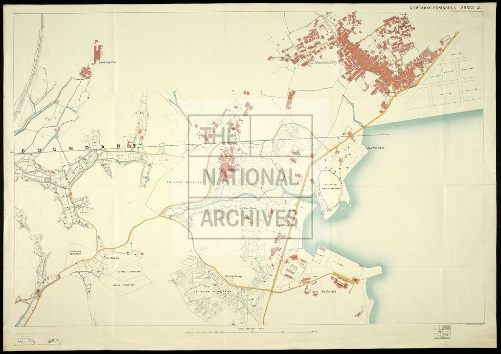
Kowloon Peninsula Hong Kong
Date:
1920
Reference:
CO 1047/455 (2)
Creator:
Colonial Office, Commonwealth and Foreign and Commonwealth Offices, Empire Marketing Board, and related bodies
Catalogue context:
'Map of the Kowloon Peninsula (including portion of New Kowloon) (New Territories) Colony of Hong Kong'. 6 sheets. Printed. 200 feet to an inch. Crown Lands and Survey Office, Public Works Department
Categories:
Overseas; Places
Subjects:
Asia; Construction industries; Crown lands and estates; International; Maps and plans
Topics:
International trade and affairs; Land and buildings
Period:
Interwar
Places:
Hong Kong
Copyright information:
Copyright clearance for publication is not required, except in the case of documents in third-party copyright.
Usage terms:
https://www.nationalarchives.gov.uk/documents/information-management/use-of-tna-materials.pdf