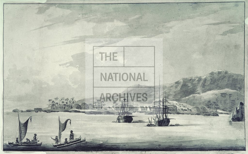
Drawing of Kealakekua Bay, Hawaii
Date:
1778-1779
Reference:
MFQ 1/566
Creator:
Maps and plans extracted to flat storage from records of various departments held at the Public Record Office, Kew
Catalogue context:
1 item extracted from ADM 55/24 . Hawaii. View of Hawaii [Owhy-he] Island showing the spot at which Captain Cook was killed. Drawn to illustrate the log of HMS Discovery for 5 August 1778 to June 1779, by Thomas Edgar, Master.
Categories:
Overseas; Places
Subjects:
Archives and libraries; Maps and plans; Navy
Topics:
Military and war; Land and buildings
Period:
Empire And Industry
Copyright information:
Copyright clearance for publication is not required, except in the case of documents in third-party copyright.
Usage terms:
https://www.nationalarchives.gov.uk/documents/information-management/use-of-tna-materials.pdf