West Coast of Africa, Congo and Gabon, Cape Lopez to Pointe Indienne; Sette River to Loango Bay
Date:
1852-1889
Reference:
ADM 344/979
Creator:
Admiralty, Naval Forces, Royal Marines, Coastguard, and related bodies
Catalogue context:
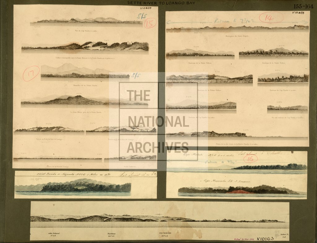
Africa, W Coast: Gulf of Guinea: Congo and Gabon: Cape Lopez to Pointe Indienne; 'Sette River to Loango Bay'; five items on one sheet: item 1, 'Point Banda or Segunda NE by E 5 Miles in 10 Fms'; item 2, 'Cape Matooti N1/2E 4 or 5 Miles' and 'Cape Mayumba SE 3 Leagues'; item 3, 'Vue du Cap Yombe', 'Colline remarquable entre la Pointe Matoote et la Pointe Banda', 'Mamelles de la Pointe Banda', 'Le Gros Morne pres de la Pointe Banda', 'Baie de Loango', 'Pointe Indienne'; item 4, 'Montagnes du Saint-Esprit', 'Pointe Pedras', 'Cap Yumba' and 'Riviere Yumba' from French Sailing Directions, c1852; item 5, untitled view, showing 'Indian Point' from German Sailing Directions, annotated
Categories:
Maps and plans; Overseas
Subjects:
Africa; Armed Forces (General Administration); Navy
Topics:
International trade and affairs; Land and buildings; Military and war
Period:
Victorians
Places:
Africa
Copyright information:
Copyright clearance for publication is not required, except in the case of documents in third-party copyright.
Usage terms:
https://www.nationalarchives.gov.uk/documents/information-management/use-of-tna-materials.pdf