Angola, Congo, Zaire, Pointe-Noire to Cap Padrao, Black Point to Congo (Zaire) River, Arica
Date:
1852-1857
Reference:
ADM 344/980
Creator:
Admiralty, Naval Forces, Royal Marines, Coastguard, and related bodies
Catalogue context:
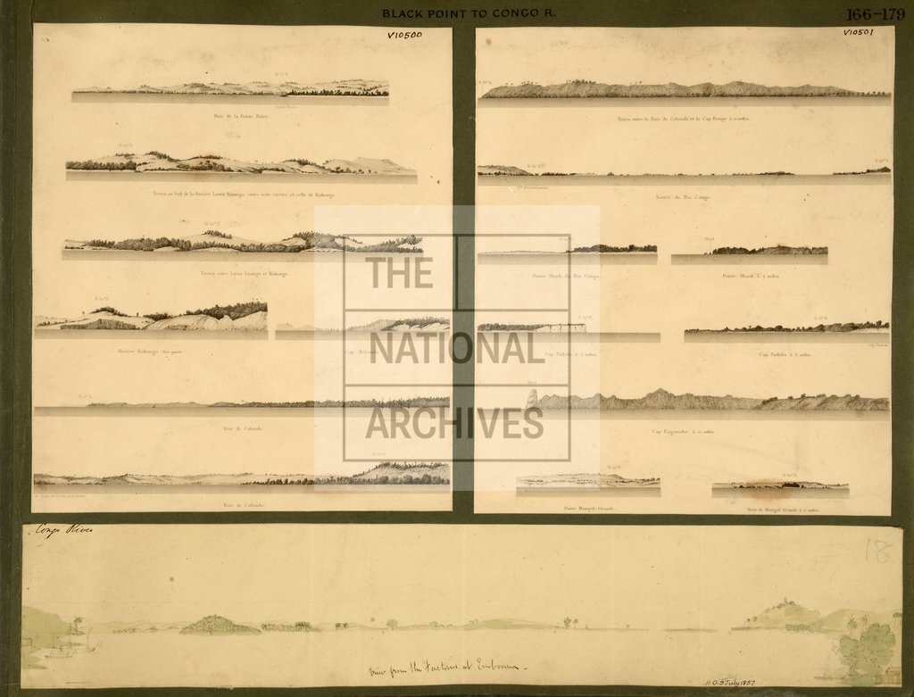
Africa, W Coast: Angola, Congo, Zaire and Cabinda Enclave: Pointe-Noire to Cap Padrao, vicinity; 'Black Point to Congo (Zaire) River'; three items on one sheet: item 1, 'View from Factories at Emboomu (Congo River)', annotated; item 2, 'Baie de la Pointe Noire', 'Riviere Luisa Loango', 'Terres entre Luisa Loango et Kakongo', 'Riviere Kakongo', 'Cap Malemba', 'Baie de Cabenda (Cabinda)'; item 3, 'Rio Congo', 'Pointe Shark', 'Cap Padrao', 'Cap Enganador' and 'Pointe Mangal-Grande' from French Sailing Directions, c1852
Categories:
Maps and plans
Subjects:
Africa; Armed Forces (General Administration); Manufacturing; Navy
Topics:
Business, finance and innovation; International trade and affairs; Land and buildings; Military and war
Period:
Victorians
Copyright information:
Copyright clearance for publication is not required, except in the case of documents in third-party copyright.
Usage terms:
https://www.nationalarchives.gov.uk/documents/information-management/use-of-tna-materials.pdf