Maine, Penmaquid Point to Isle aux Haut
Date:
1765-1775
Reference:
ADM 352/159
Creator:
Admiralty, Naval Forces, Royal Marines, Coastguard, and related bodies
Catalogue context:
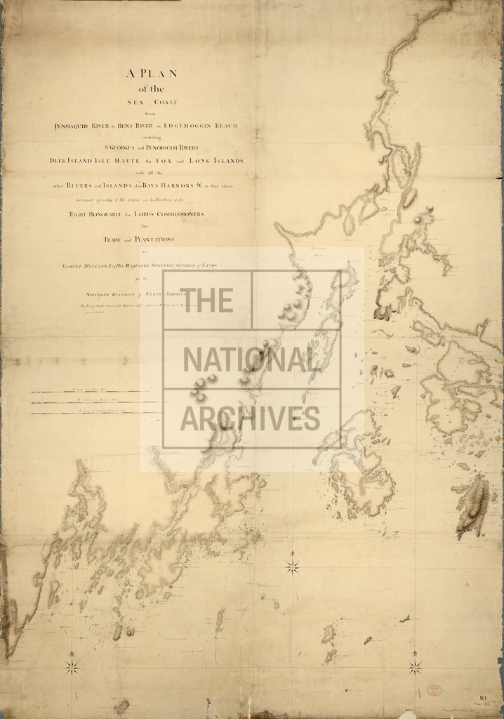
United States: Maine: Penmaquid Point to Isle aux Haut, including Penobscot Bay. By George Sproule, 59th Regiment of Foot, and James Grant. Supervised by Samuel Holland, HM Surveyor General of Lands. Shows coastline, topography and hydrography. Annotated. Scales: 14 5/8 inches to 11 statutory miles; 16 3/4 inches to 11 marine miles and 16 3/8 inches to 65 000 feet
Categories:
Maps and plans
Subjects:
Navy
Topics:
Military and war; Land and buildings
Period:
Empire And Industry
Copyright information:
Copyright clearance for publication is not required, except in the case of documents in third-party copyright.
Usage terms:
https://www.nationalarchives.gov.uk/documents/information-management/use-of-tna-materials.pdf