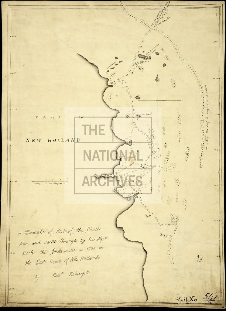
Cape Flattery to Cape Tribulation, including the Great Barrier Reef, Australia
Date:
1770
Reference:
ADM 352/382
Creator:
Admiralty, Naval Forces, Royal Marines, Coastguard, and related bodies
Catalogue context:
Australia: Cape Flattery to Cape Tribulation, vicinity, including the Great Barrier Reef: 'A Draught of Part of the Shoals seen and sailed through by HM Bark Endeavour in 1770 on the East Coast of New Holland'. By Richard Pickersgill. Shows coastline, hydrography, ship's tracks and remarks. Scale: 2 1/2 inches to 5 leagues
Categories:
Maps and plans; Overseas
Subjects:
Armed Forces (General Administration); Australia and Pacific; Europe and Russia; Navy
Topics:
International trade and affairs; Land and buildings; Military and war
Period:
Empire And Industry
Places:
Australia
Copyright information:
Copyright clearance for publication is not required, except in the case of documents in third-party copyright.
Usage terms:
https://www.nationalarchives.gov.uk/documents/information-management/use-of-tna-materials.pdf