Route Map of Abyssinia, Africa
Date:
1867
Reference:
CO 700/AFRICA8
Creator:
Colonial Office, Commonwealth and Foreign and Commonwealth Offices, Empire Marketing Board, and related bodies
Catalogue context:
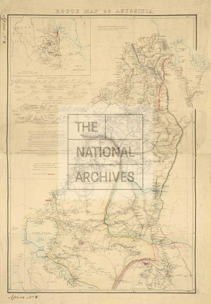
Route Map of Abyssinia, showing advance, and Stations, of the British Expedition. Compiled by E. G. Ravenstein, F.R.G.S. 10 miles to 1 inch. Author, Publisher, &c.: War Office, London
Categories:
Maps and plans; Overseas
Subjects:
Africa; Armed Forces (General Administration); Army; Europe and Russia; International; Maps and plans
Topics:
International trade and affairs; Land and buildings; Military and war
Period:
Victorians
Places:
Africa
Copyright information:
Copyright clearance for publication is not required, except in the case of documents in third-party copyright.
Usage terms:
https://www.nationalarchives.gov.uk/documents/information-management/use-of-tna-materials.pdf