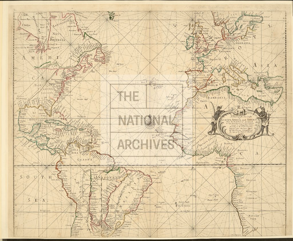
Chart of the sea coasts of Europe, Africa and America, by John Thornton
Date:
1710
Reference:
CO 700/AmericaNorthandSouth5
Creator:
Colonial Office, Commonwealth and Foreign and Commonwealth Offices, Empire Marketing Board, and related bodies
Catalogue context:
A Chart of the Sea Coasts of Europe, Africa, and America, from the North Parts of Scotland to Cape Bona Esperanca, and from Hudsons Straits to ye Maggellan Straits, according to Mr. Wright's Projection, vulgerly called Mercator's Chart. By John Thornton, Hydrographer...London.
Categories:
Maps and plans; Overseas
Subjects:
Africa; Americas; Europe and Russia; International; Maps and plans
Topics:
International trade and affairs; Land and buildings
Period:
Early Modern
Places:
Africa
Copyright information:
Copyright clearance for publication is not required, except in the case of documents in third-party copyright.
Usage terms:
https://www.nationalarchives.gov.uk/documents/information-management/use-of-tna-materials.pdf