Antigua
Date:
1852
Reference:
CO 700/ANTIGUA11 (2) (right half)
Creator:
Colonial Office, Commonwealth and Foreign and Commonwealth Offices, Empire Marketing Board, and related bodies
Catalogue context:
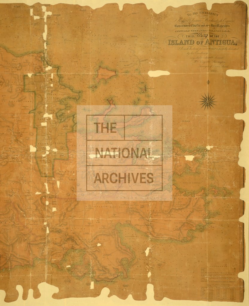
Map of the Island of Antigua, by William Musgrave Shervington, Surveyor of Crown Lands, 1852. 2½ inches to 1 mile. Author, Publisher, &c.: Official [London].
Categories:
Maps and plans
Subjects:
Caribbean; Crown lands and estates; International; Maps and plans
Topics:
International trade and affairs; Land and buildings
Period:
Victorians
Copyright information:
Copyright clearance for publication is not required, except in the case of documents in third-party copyright.
Usage terms:
https://www.nationalarchives.gov.uk/documents/information-management/use-of-tna-materials.pdf