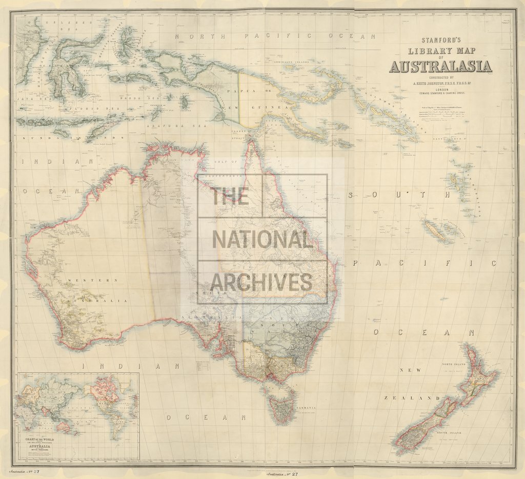
Stanford's Library map of Australasia
Date:
1872
Reference:
CO 700/AUSTRALIA27
Creator:
Colonial Office, Commonwealth and Foreign and Commonwealth Offices, Empire Marketing Board, and related bodies
Catalogue context:
Stanford's Library map of Australasia. Constructed by A. Keith Johnston, FRGS. Published 10 May 1859, by Edward Stanford, London. Additions to 1872. About 1 inch to 64 miles.
Categories:
Maps and plans
Subjects:
Australia and Pacific; International; Maps and plans
Topics:
International trade and affairs; Land and buildings
Period:
Victorians
Copyright information:
Copyright clearance for publication is not required, except in the case of documents in third-party copyright.
Usage terms:
https://www.nationalarchives.gov.uk/documents/information-management/use-of-tna-materials.pdf