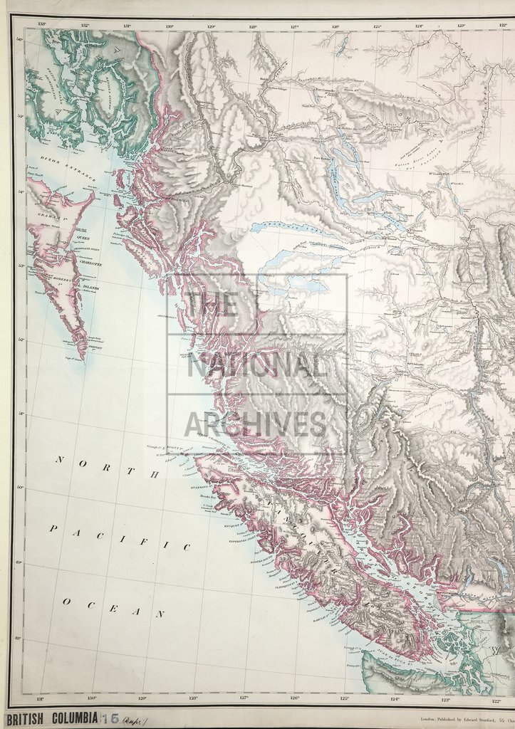
British Columbia to the 56th Parallel North Latitude
Date:
1871
Reference:
CO 700/BritishColumbia15 (1 of 2)
Creator:
Colonial Office, Commonwealth and Foreign and Commonwealth Offices, Empire Marketing Board, and related bodies
Catalogue context:
Map of British Columbia to the 56th Parallel North Latitude. Compiled and drawn at the Lands and Works Office, Victoria, B.C., under the direction of the Hon. J. W. Trutch, Chief Commissioner of Lands and Works, and Surveyor General, 1871. Published by E. Stanford, October 8th 1871. (3 other copies with Cases.) 25 miles to 1 inch.
Categories:
Maps and plans
Subjects:
International; Maps and plans
Topics:
International trade and affairs; Land and buildings
Period:
Victorians
Copyright information:
Copyright clearance for publication is not required, except in the case of documents in third-party copyright.
Usage terms:
https://www.nationalarchives.gov.uk/documents/information-management/use-of-tna-materials.pdf