British Guiana
Date:
1798
Reference:
CO 700/BritishGuiana9 (Left half)
Creator:
Colonial Office, Commonwealth and Foreign and Commonwealth Offices, Empire Marketing Board, and related bodies
Catalogue context:
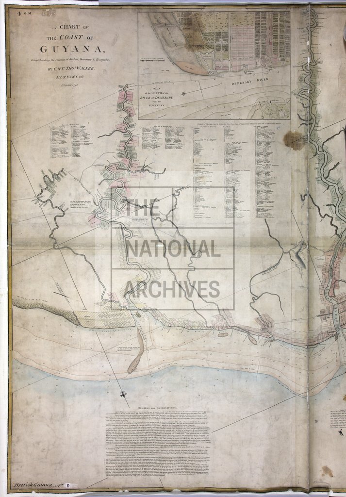
Chart of the Coast of Guyana, comprehending the Colonies of Berbice, Demerary, and Essequebo by Captain Thomas Walker, Assistant Quarter-Master General, 1st October, 1798 [London]. With inset Plan of the mouth of the River Demerary with the environs. About 3 miles to 1 inch.
Categories:
Maps and plans
Subjects:
Americas; International; Maps and plans
Topics:
International trade and affairs; Land and buildings
Period:
Empire And Industry
Copyright information:
Copyright clearance for publication is not required, except in the case of documents in third-party copyright.
Usage terms:
https://www.nationalarchives.gov.uk/documents/information-management/use-of-tna-materials.pdf