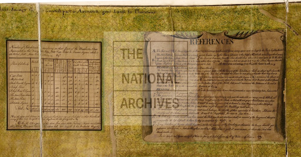
Moschetto Shore from Cape River to Brewers Lagoon
Date:
1751
Reference:
CO 700/BritishHonduras4 (references detail)
Creator:
Colonial Office, Commonwealth and Foreign and Commonwealth Offices, Empire Marketing Board, and related bodies
Catalogue context:
Part of the Moschetto Shore from Cape River to Brewers Lagoone, with the number of inhabitants residing on that part of the Shore, and the fortifications at Black River, 28th May, 1751. M.S. 3 inches to 1 mile. Author, Publisher, &c.: [Official, Kingston]
Categories:
Maps and plans
Subjects:
Americas; International; Maps and plans
Topics:
International trade and affairs; Land and buildings
Period:
Empire And Industry
Copyright information:
Copyright clearance for publication is not required, except in the case of documents in third-party copyright.
Usage terms:
https://www.nationalarchives.gov.uk/documents/information-management/use-of-tna-materials.pdf