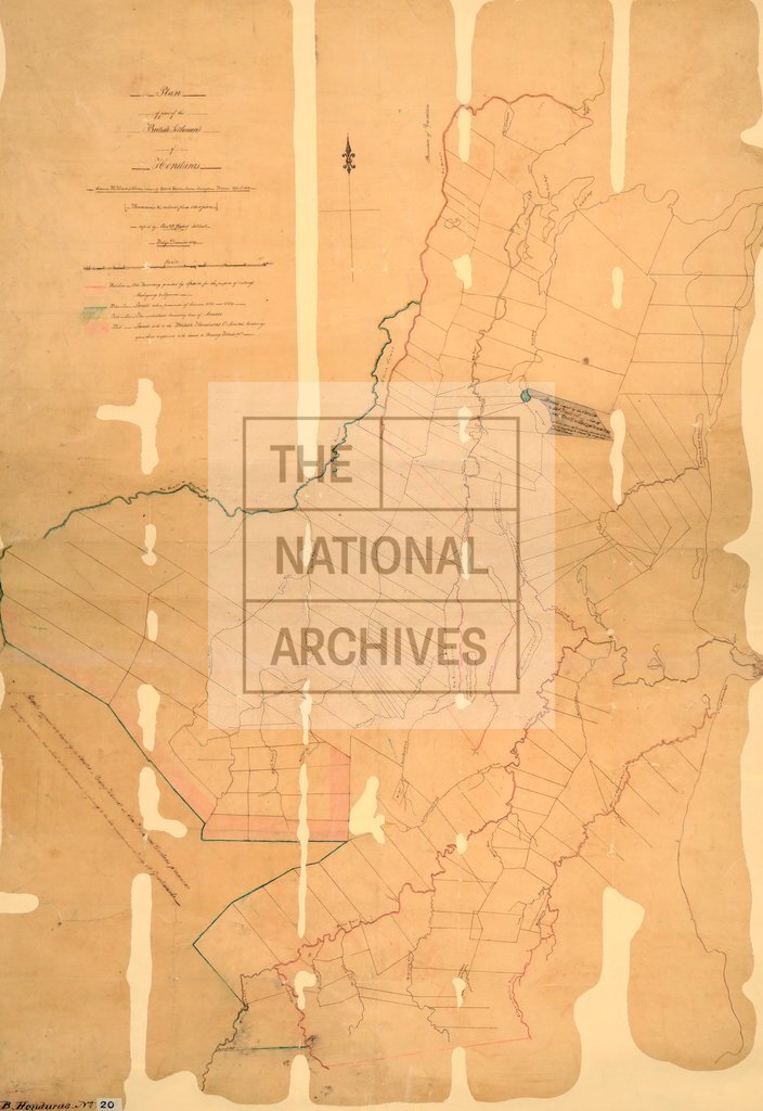
British Honduras settlements between Rio Hondo and Sibun
Date:
1858
Reference:
CO 700/BritishHonduras20
Creator:
Colonial Office, Commonwealth and Foreign and Commonwealth Offices, Empire Marketing Board, and related bodies
Catalogue context:
Plan of part of the British Settlement of Honduras between Rio Hondo and Sibun. Drawn by Robert Hume, sworn Surveyor, Belize, April, 1858. M.S. 2 miles to 1 inch.
Categories:
Maps and plans
Subjects:
Americas; International; Maps and plans
Topics:
International trade and affairs; Land and buildings
Period:
Victorians
Copyright information:
Copyright clearance for publication is not required, except in the case of documents in third-party copyright.
Usage terms:
https://www.nationalarchives.gov.uk/documents/information-management/use-of-tna-materials.pdf