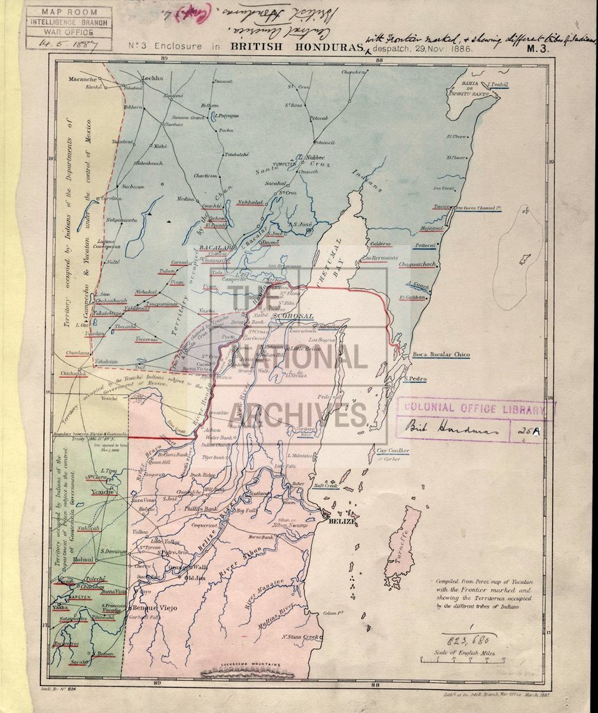
Honduras, with frontir and differnt tribes of indians
Date:
1886
Reference:
CO 700/BritishHonduras25 (2)
Creator:
Colonial Office, Commonwealth and Foreign and Commonwealth Offices, Empire Marketing Board, and related bodies
Catalogue context:
Mountain Region of British Honduras. [Tracing.] About 6 miles to 1 inch. Author, Publisher, &c.: [Wilson, C. H, Belize]
Categories:
Maps and plans
Subjects:
Americas; International; Maps and plans
Topics:
International trade and affairs; Land and buildings
Period:
Victorians
Copyright information:
Copyright clearance for publication is not required, except in the case of documents in third-party copyright.
Usage terms:
https://www.nationalarchives.gov.uk/documents/information-management/use-of-tna-materials.pdf