Province of Upper Canada
Date:
1800
Reference:
CO 700/CANADA61
Creator:
Colonial Office, Commonwealth and Foreign and Commonwealth Offices, Empire Marketing Board, and related bodies
Catalogue context:
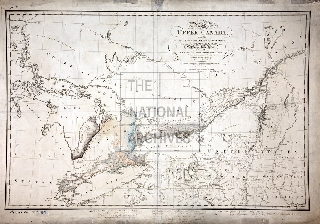
A map of the Province of Upper Canada, describing all the New Settlements, Townships, etc., with the Countries adjacent from Quebec to Lake Huron. Compiled...by David William Smyth, Esqr., Surveyor General. London, published by W. Faden, April 12th, 1800. Accompanied with a Topographical Description. 23 miles to 1 inch.
Categories:
Maps and plans; Overseas
Subjects:
Americas; International; Maps and plans
Topics:
International trade and affairs; Land and buildings
Period:
Empire And Industry
Places:
Canada
Copyright information:
Copyright clearance for publication is not required, except in the case of documents in third-party copyright.
Usage terms:
https://www.nationalarchives.gov.uk/documents/information-management/use-of-tna-materials.pdf