Province of Upper Canada and Adjacent Territories in North America
Date:
1826
Reference:
CO 700/CANADA81
Creator:
Colonial Office, Commonwealth and Foreign and Commonwealth Offices, Empire Marketing Board, and related bodies
Catalogue context:
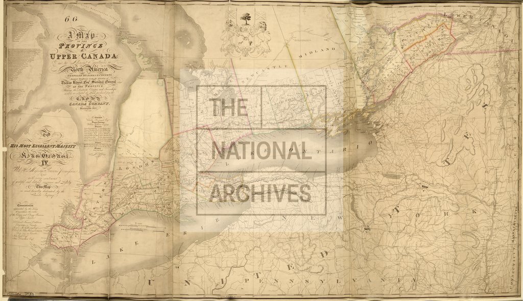
A map of the Province of Upper Canada and the Adjacent Territories in North America. Compiled by James G. Chewett...shewing the Districts, Counties and Townships in which are situated the Lands purchased from the Crown by the Canada Company. Incorporated1825. Engraved by J. S. Cox for the Canada Company. [London]. MS. 8 miles to 1 inch.
Categories:
Maps and plans; Overseas
Subjects:
Americas; International; Maps and plans
Topics:
International trade and affairs; Land and buildings
Period:
Empire And Industry
Places:
Canada
Copyright information:
Copyright clearance for publication is not required, except in the case of documents in third-party copyright.
Usage terms:
https://www.nationalarchives.gov.uk/documents/information-management/use-of-tna-materials.pdf