North-West part of Canada, Indian Territories, and Hudson's Bay
Date:
1857
Reference:
CO 700/CANADA109
Creator:
Colonial Office, Commonwealth and Foreign and Commonwealth Offices, Empire Marketing Board, and related bodies
Catalogue context:
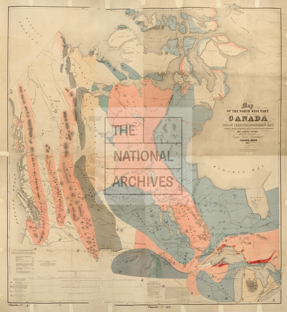
Map of North-West part of Canada, Indian Territories, and Hudson's Bay, compiled and drawn by Thomas Devine, Provincial Land Surveyor, by order of the Hon. J. Cauchon, Commissioner of Crown Lands. Toronto, March, 1857. geologically coloured.) 40 miles to1 inch.
Categories:
Maps and plans; Overseas
Subjects:
Americas; Crown lands and estates; International; Maps and plans
Topics:
International trade and affairs; Land and buildings
Period:
Victorians
Places:
Canada
Copyright information:
Copyright clearance for publication is not required, except in the case of documents in third-party copyright.
Usage terms:
https://www.nationalarchives.gov.uk/documents/information-management/use-of-tna-materials.pdf