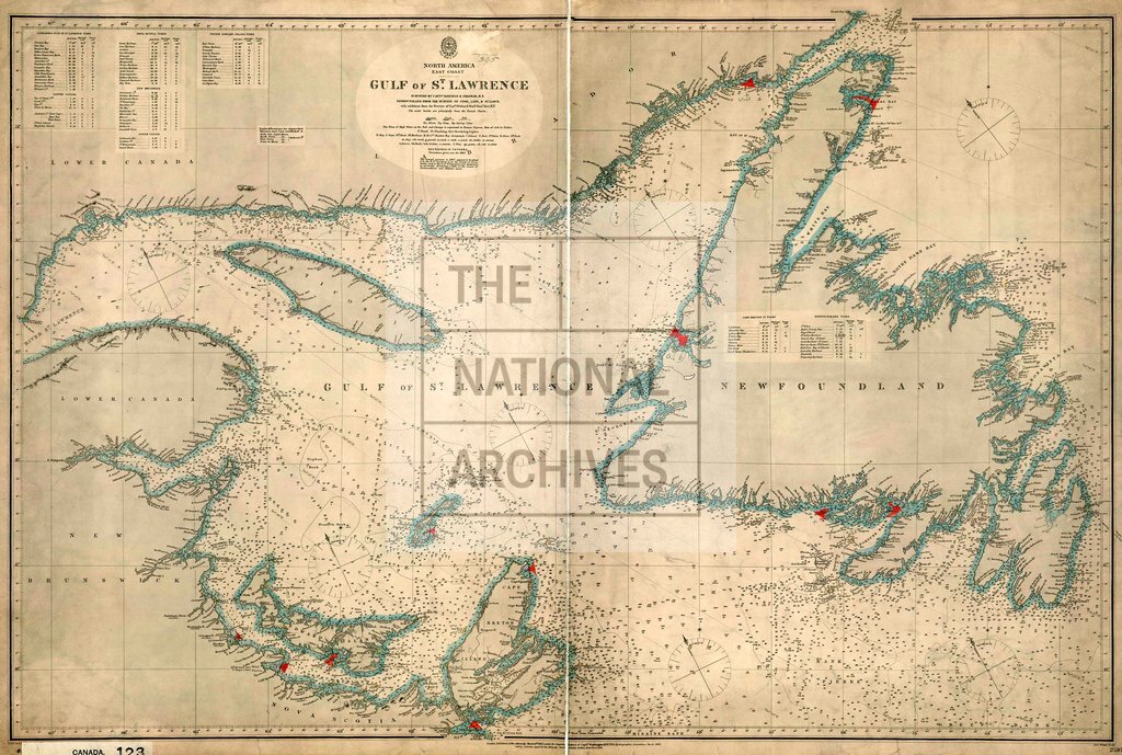
Gulf of St Lawrence, Canada
Date:
1867
Reference:
CO 700/CANADA123
Creator:
Colonial Office, Commonwealth and Foreign and Commonwealth Offices, Empire Marketing Board, and related bodies
Catalogue context:
Gulf of St. Lawrence. Surveyed by Captains Bayfield and Orlebar, R.N., and others, with MS. additions. About 18 miles to 1 inch. Author, Publisher, &c.: Admiralty (No. 2516) London.
Categories:
Maps and plans; Overseas
Subjects:
Americas; Armed Forces (General Administration); International; Maps and plans; Navy
Topics:
International trade and affairs; Land and buildings; Military and war
Period:
Victorians
Places:
Canada
Copyright information:
Copyright clearance for publication is not required, except in the case of documents in third-party copyright.
Usage terms:
https://www.nationalarchives.gov.uk/documents/information-management/use-of-tna-materials.pdf