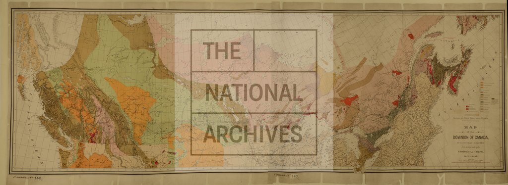
Dominion of Canada, geologically coloured from surveys by the Geological Corps
Date:
1884
Reference:
CO 700/CANADA143
Creator:
Colonial Office, Commonwealth and Foreign and Commonwealth Offices, Empire Marketing Board, and related bodies
Catalogue context:
Map of the Dominion of Canada, geologically coloured from surveys made by the Geological Corps, 1842-1882. 45 miles to 1 inch. Author, Publisher, &c.: Geological Survey [Montreal]
Categories:
Maps and plans; Overseas
Subjects:
Americas; International; Maps and plans
Topics:
International trade and affairs; Land and buildings; Military and war
Period:
Victorians
Places:
Canada
Copyright information:
Copyright clearance for publication is not required, except in the case of documents in third-party copyright.
Usage terms:
https://www.nationalarchives.gov.uk/documents/information-management/use-of-tna-materials.pdf