Canadian Pacific railway
Date:
1895
Reference:
CO 700/CANADA150
Creator:
Colonial Office, Commonwealth and Foreign and Commonwealth Offices, Empire Marketing Board, and related bodies
Catalogue context:
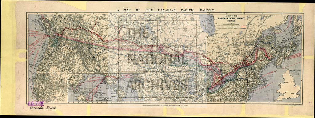
A map of the Canadian Pacific Railway System. Published by Edward Stanford, London, August 26th, 1895. About 88 miles to 1 inch.
Categories:
Maps and plans; Overseas
Subjects:
Americas; International; Maps and plans; Railways
Topics:
International trade and affairs; Land and buildings; Transport and travel
Period:
Victorians
Places:
Canada
Copyright information:
Copyright clearance for publication is not required, except in the case of documents in third-party copyright.
Usage terms:
https://www.nationalarchives.gov.uk/documents/information-management/use-of-tna-materials.pdf