Military chart of South-Eastern frontier of Cape of Good Hope
Date:
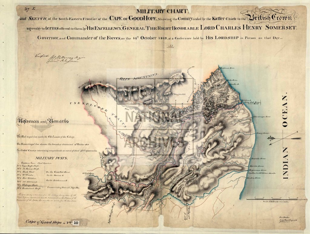
1849
Reference:
CO 700/CapeofGoodHope10
Creator:
Colonial Office, Commonwealth and Foreign and Commonwealth Offices, Empire Marketing Board, and related bodies
Catalogue context:
Military Chart and Sketch of the South-Eastern Frontier of the Cape of Good Hope, showing the Country ceded by the Kaffer chiefs to the British Crown agreeably to terms offered to them by H.E. General the Right Hon. Lord Charles Henry Somerset, Governor and Commander of the Forces, on the 14th October, 1819, at a Conference held by his Lordship in person on that day. 6 miles to 1 inch. Author, Publisher, &c.: Stocker, Lieut. Ives, R.E., [Cape Town]
Categories:
Maps and plans
Subjects:
Armed Forces (General Administration); International; Maps and plans
Topics:
International trade and affairs; Land and buildings; Military and war
Period:
Empire And Industry
Copyright information:
Copyright clearance for publication is not required, except in the case of documents in third-party copyright.
Usage terms:
https://www.nationalarchives.gov.uk/documents/information-management/use-of-tna-materials.pdf