Cape of Good Hope
Date:
1895
Reference:
CO 700/CapeofGoodHope37
Creator:
Colonial Office, Commonwealth and Foreign and Commonwealth Offices, Empire Marketing Board, and related bodies
Catalogue context:
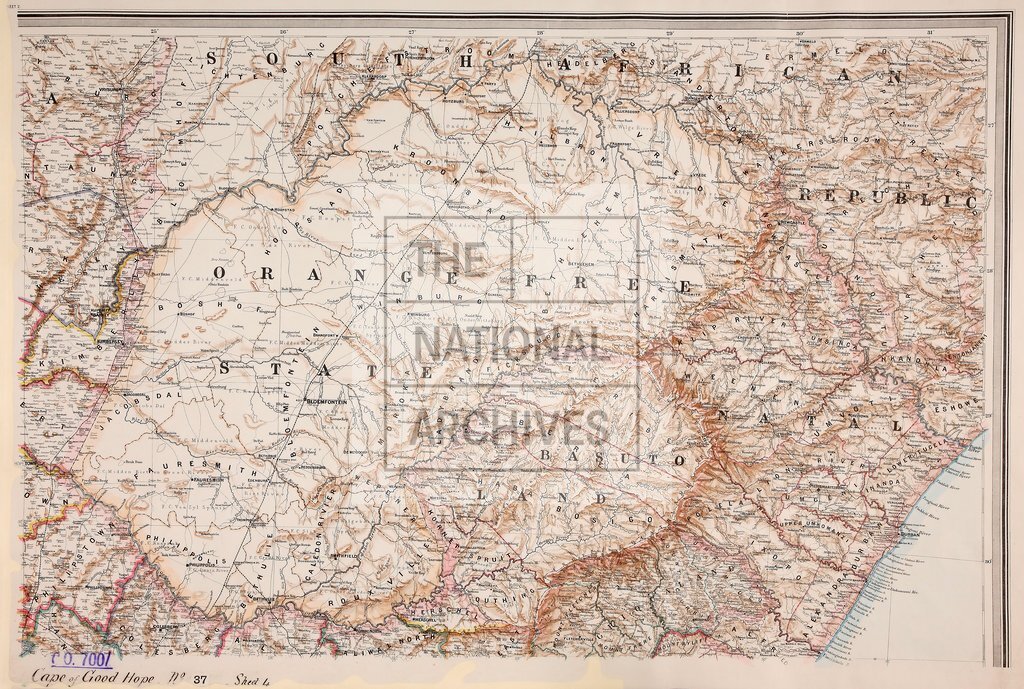
Map of the Colony of the Cape of Good Hope and neighbouring Territories. Compiled from the best available information. J. Templer-Home, Surveyor-General, Cape Town. 12.62 miles to 1 inch.
Categories:
Maps and plans
Subjects:
International; Maps and plans
Topics:
International trade and affairs; Land and buildings
Period:
Victorians
Copyright information:
Copyright clearance for publication is not required, except in the case of documents in third-party copyright.
Usage terms:
https://www.nationalarchives.gov.uk/documents/information-management/use-of-tna-materials.pdf