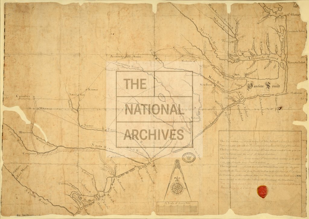
Movement of forces in the Carolinas and controverted bounds with Virginia c1715
Date:
1715
Reference:
CO 700/CAROLINA4
Creator:
Colonial Office, Commonwealth and Foreign and Commonwealth Offices, Empire Marketing Board, and related bodies
Catalogue context:
Map of Carolina. Showing the route of the Forces sent in the years 1711, 1712, and 1713 from South Carolina to the relief of North Carolina, and in 1715 of the Forces sent from North Carolina to the assistance of South Carolina, also showing the controverted Bounds between Virginia and Carolina. MS. About 15 miles to 1 inch.
Categories:
Maps and plans
Subjects:
Americas; Armed Forces (General Administration); International; Maps and plans
Topics:
International trade and affairs; Land and buildings; Military and war
Period:
Early Modern
Copyright information:
Copyright clearance for publication is not required, except in the case of documents in third-party copyright.
Usage terms:
https://www.nationalarchives.gov.uk/documents/information-management/use-of-tna-materials.pdf