Division line between North and South Carolina
Date:
1730
Reference:
CO 700/CAROLINA8
Creator:
Colonial Office, Commonwealth and Foreign and Commonwealth Offices, Empire Marketing Board, and related bodies
Catalogue context:
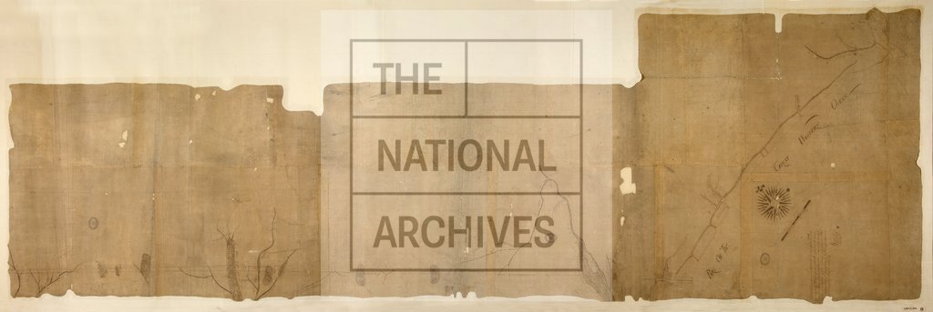
A Map of the division line between the Provinces of North and South Carolina, containing thirty miles along the Sea Coast from the Mouth of Cape fear River, and from thence continued on a N.W. Course for sixty-two miles and one quarter. Survey'd in the presence Robert Holton, Matthew Rowan and Edward Moseley, Commissioners on the part of North Carolina. By W. Gray, Surveyor. MS. 1 mile to 1 inch.
Categories:
Maps and plans
Subjects:
Americas; International; Maps and plans
Topics:
International trade and affairs; Land and buildings
Period:
Early Modern
Copyright information:
Copyright clearance for publication is not required, except in the case of documents in third-party copyright.
Usage terms:
https://www.nationalarchives.gov.uk/documents/information-management/use-of-tna-materials.pdf