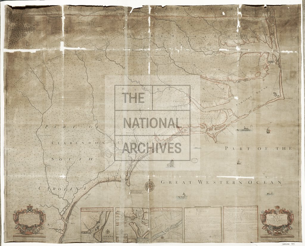
North Carolina by Edward Moseley
Date:
1733
Reference:
CO 700/CAROLINA11
Creator:
Colonial Office, Commonwealth and Foreign and Commonwealth Offices, Empire Marketing Board, and related bodies
Catalogue context:
A new and correct Map of the Province of North Carolina. By Edward Moseley, late Surveyor-General of the said Province, 1733. S. Cowley, Sculp. 5 miles to 1 inch. [Insets: Port Brunswick or Cape Fear Harbour, Port Beaufort or Topsail Inlet, Ocacock Inlet.]
Categories:
Maps and plans
Subjects:
Americas; International; Maps and plans
Topics:
International trade and affairs; Land and buildings
Period:
Early Modern
Copyright information:
Copyright clearance for publication is not required, except in the case of documents in third-party copyright.
Usage terms:
https://www.nationalarchives.gov.uk/documents/information-management/use-of-tna-materials.pdf