Boundary between Kenya Colony and the Uganda Protectorate
Date:
1924
Reference:
CO 1047/142 (2)
Creator:
Colonial Office, Commonwealth and Foreign and Commonwealth Offices, Empire Marketing Board, and related bodies
Catalogue context:
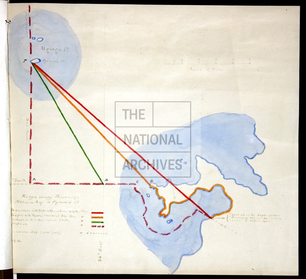
'Plan Shewing Revised Boundary between Uganda Protectorate and Kenya Colony'. Printed. Also three enlargements of portion of boundary, MS plan of boundary across Lake Victoria and typescript 'Description of Boundary between Kenya Colony and the Uganda Protectorate'. Printed. 1:1,000,000 (main map). Bound in triplicate
Categories:
Maps and plans; Overseas
Subjects:
International
Topics:
International trade and affairs; Land and buildings
Period:
Interwar
Places:
Africa; Kenya
Copyright information:
Copyright clearance for publication is not required, except in the case of documents in third-party copyright.
Usage terms:
https://www.nationalarchives.gov.uk/documents/information-management/use-of-tna-materials.pdf