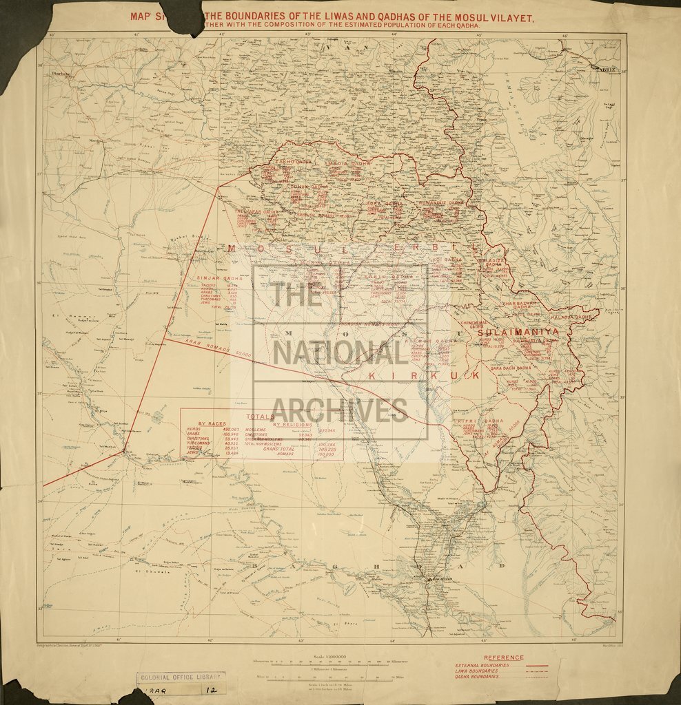
Boundaries of the Luiras and Qadhas of the Mosul Vilayet
Date:
1925
Reference:
CO 1047/470
Creator:
Colonial Office, Commonwealth and Foreign and Commonwealth Offices, Empire Marketing Board, and related bodies
Catalogue context:
G.S.G.S. 3768A: 'Map Showing the Boundaries of the Luiras and Qadhas of the Mosul Vilayet, together with the composition of the estimated population of each qadha'. Printed, with coloured overprinting showing qadha information. 1:1,000,000
Categories:
Maps and plans
Subjects:
International; Maps and plans; Middle East
Topics:
International trade and affairs; Land and buildings
Period:
Interwar
Copyright information:
Copyright clearance for publication is not required, except in the case of documents in third-party copyright.
Usage terms:
https://www.nationalarchives.gov.uk/documents/information-management/use-of-tna-materials.pdf