Division of land in Dominica
Date:
1776
Reference:
CO 700/DOMINICA6
Creator:
Colonial Office, Commonwealth and Foreign and Commonwealth Offices, Empire Marketing Board, and related bodies
Catalogue context:
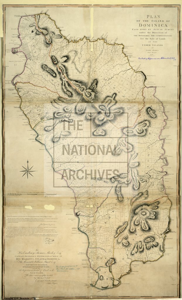
Plan of the Island of Dominica, laid down by actual Survey under the direction of the Honourable the Commissioners for the sale of Lands in the ceded Islands, by John Byres, London. Chief Surveyor, in 1776. [For text see No. 2362, sm. 8vo. in Book Catalogue.] 2 inches to 1 mile.
Categories:
Maps and plans
Subjects:
Caribbean; International; Maps and plans
Topics:
International trade and affairs; Land and buildings
Period:
Empire And Industry
Copyright information:
Copyright clearance for publication is not required, except in the case of documents in third-party copyright.
Usage terms:
https://www.nationalarchives.gov.uk/documents/information-management/use-of-tna-materials.pdf