East Florida
Date:
1764
Reference:
CO 700/FLORIDA7
Creator:
Colonial Office, Commonwealth and Foreign and Commonwealth Offices, Empire Marketing Board, and related bodies
Catalogue context:
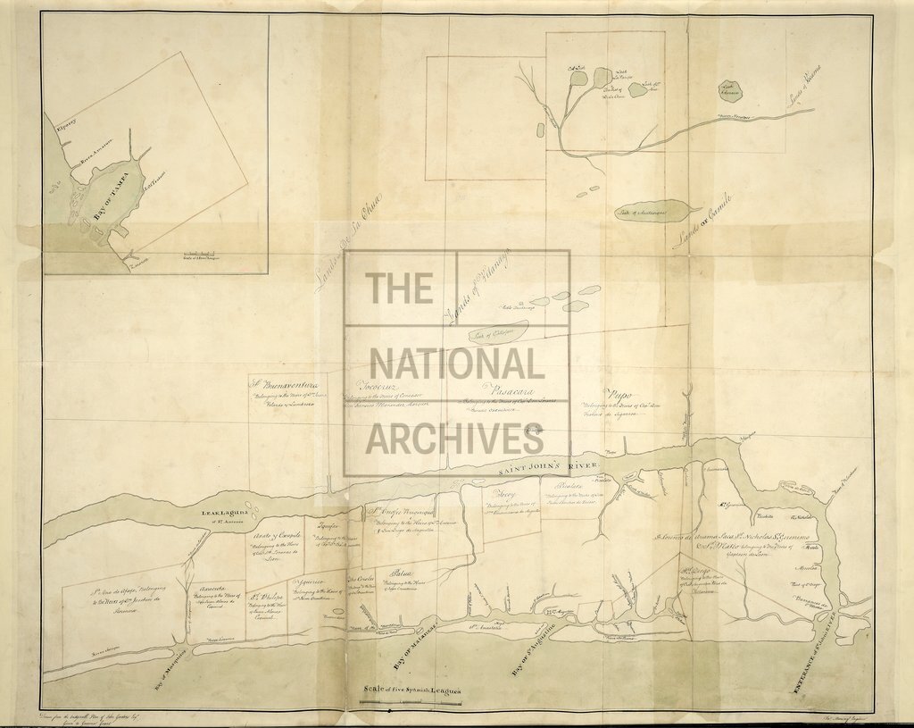
Map of part of East Florida from St. John's River to Bay of Mosquitos, showing names of proprietors of estates. Drawn from the originall plan of John Gordons, Esquire, given to Governor Grant. Jas. Moncrief, Engineer. MS. 1 league to 1 inch.
Categories:
Maps and plans
Subjects:
Americas; International; Maps and plans
Topics:
International trade and affairs; Land and buildings
Period:
Empire And Industry
Copyright information:
Copyright clearance for publication is not required, except in the case of documents in third-party copyright.
Usage terms:
https://www.nationalarchives.gov.uk/documents/information-management/use-of-tna-materials.pdf