East Florida, by William Stork [1767]
Date:
1767
Reference:
CO 700/FLORIDA34
Creator:
Colonial Office, Commonwealth and Foreign and Commonwealth Offices, Empire Marketing Board, and related bodies
Catalogue context:
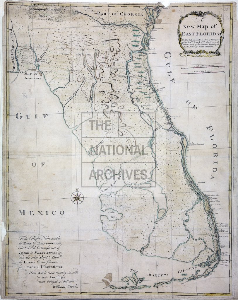
A new Map of East Florida. By William Stork. N.B.-The Eastern Coast is taken by permission of the Honble. Board of Trade from a late actual survey of the Surveyor General of the South District of North America. P. Andrews, Sculp. (2 copies.) 18 miles to 1 inch.
Categories:
Maps and plans
Subjects:
Americas; International; Maps and plans; Trade and commerce
Topics:
International trade and affairs; Land and buildings
Period:
Empire And Industry
Copyright information:
Copyright clearance for publication is not required, except in the case of documents in third-party copyright.
Usage terms:
https://www.nationalarchives.gov.uk/documents/information-management/use-of-tna-materials.pdf