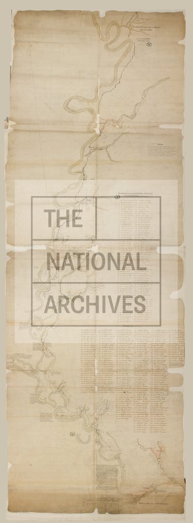
Mississippi River, from River Iberville to Province of West Florida c1770
Date:
1770
Reference:
CO 700/FLORIDA38
Creator:
Colonial Office, Commonwealth and Foreign and Commonwealth Offices, Empire Marketing Board, and related bodies
Catalogue context:
Map of the Mississipi River, from the River Iberville to the North boundary line of the Province of West Florida on the River Yazous. With reference to the lands surveyed and granted on the River Mississipi and parts adjacent. Showing also list of Proprietors. Surveyed by Captain Elias Durnford, Engineer. MS. 1½ miles to 1 inch.
Categories:
Maps and plans
Subjects:
Americas; International; Maps and plans
Topics:
International trade and affairs; Land and buildings
Period:
Empire And Industry
Copyright information:
Copyright clearance for publication is not required, except in the case of documents in third-party copyright.
Usage terms:
https://www.nationalarchives.gov.uk/documents/information-management/use-of-tna-materials.pdf