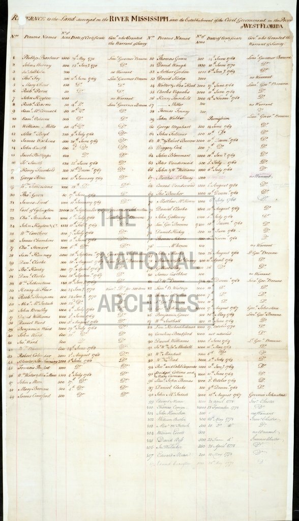
Land surveyed along the River Mississippi from the River Yasous to the River Ibberville in West Florida
Date:
1771
Reference:
CO 700/FLORIDA45 (1)
Creator:
Colonial Office, Commonwealth and Foreign and Commonwealth Offices, Empire Marketing Board, and related bodies
Catalogue context:
Plan of the River Mississippi from the River Yasous to the River Ibberville in West Florida. Showing lands granted and names of Proprietors. With a schedule. [By Elias Durnford.] MS. 4 miles to 1 inch.
Categories:
Maps and plans
Subjects:
Americas; International; Maps and plans
Topics:
International trade and affairs; Land and buildings
Period:
Empire And Industry
Copyright information:
Copyright clearance for publication is not required, except in the case of documents in third-party copyright.
Usage terms:
https://www.nationalarchives.gov.uk/documents/information-management/use-of-tna-materials.pdf