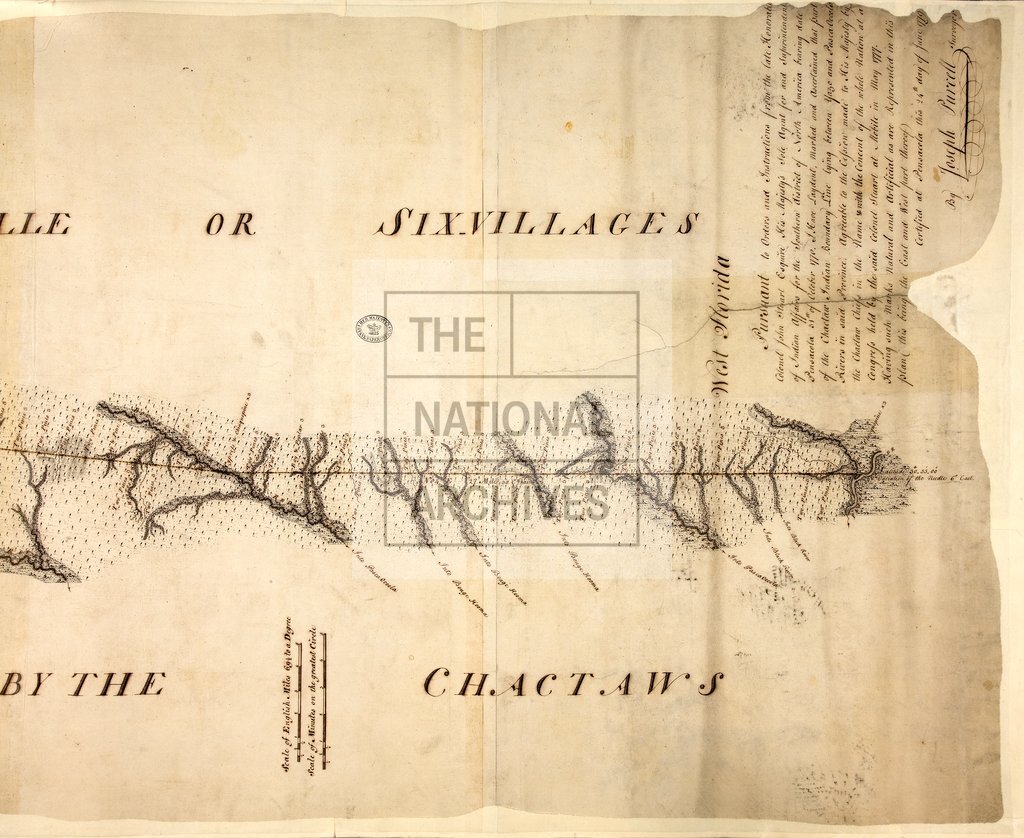
Boundary of Lands ceded to His Majesty by the Chactaw Indians
Date:
1779
Reference:
CO 700/FLORIDA56 (2) (4 of 4)
Creator:
Colonial Office, Commonwealth and Foreign and Commonwealth Offices, Empire Marketing Board, and related bodies
Catalogue context:
Map of the Boundary Line of the Lands ceded to His Majesty by the Chactaw Indians, from the north boundary of West Florida on the Yazo River to the River Pasca Ocoola, in two sheets. Certified at Pensacola the 24th day of June 1779 by Joseph Purcell, Surveyor. MS. 1¼ miles to 1 inch.
Categories:
Maps and plans
Subjects:
Americas; International; Maps and plans
Topics:
International trade and affairs; Land and buildings
Period:
Empire And Industry
Copyright information:
Copyright clearance for publication is not required, except in the case of documents in third-party copyright.
Usage terms:
https://www.nationalarchives.gov.uk/documents/information-management/use-of-tna-materials.pdf