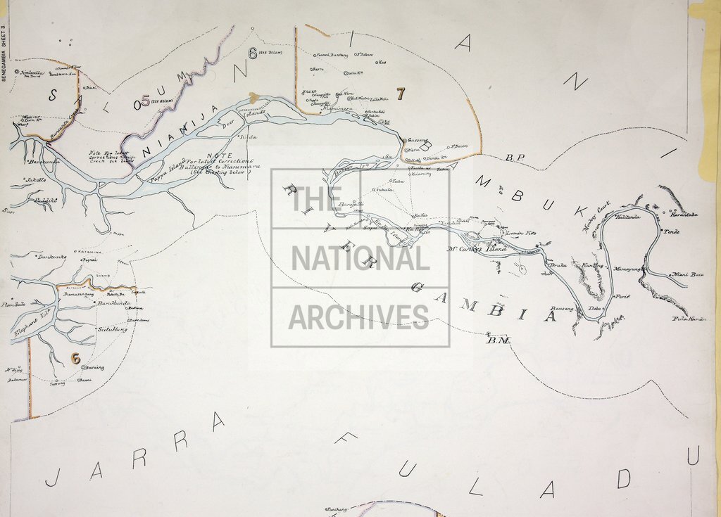
Senegambia (sheet 3)
Date:
1895
Reference:
CO 700/GAMBIA25 (3b)
Creator:
Colonial Office, Commonwealth and Foreign and Commonwealth Offices, Empire Marketing Board, and related bodies
Catalogue context:
Map of the Boundary between the English and French Possessions in Senegambia, from the coast to the points beyond which the boundary follows the River Gambia at an even distance of ten kilometres from either bank. Surveyed by the Anglo-French Commission of Delimitation from December 1890, to April 1891. 2 miles to 1 inch. Author, Publisher, &c.: Administrator of the Gambia. War Office (No. 1121) London.
Categories:
Maps and plans
Subjects:
Africa; Armed Forces (General Administration); Army; Banking; International; Maps and plans; Operations, battles and campaigns
Topics:
Business, finance and innovation; International trade and affairs; Land and buildings; Military and war
Period:
Victorians
Copyright information:
Copyright clearance for publication is not required, except in the case of documents in third-party copyright.
Usage terms:
https://www.nationalarchives.gov.uk/documents/information-management/use-of-tna-materials.pdf